Remember that last post about getting places no one had ever been? This is not that post. You will not be alone on this hike. You won’t feel like you’re exploring uncharted wilderness. But you will find yourself on an almost perfect-length hike (with many options to make it longer) in a stunningly beautiful spot that will leave you begrudgingly admitting to yourself why housing prices in the Bay Area are so ridiculously expensive. (Begrudgingly, I said.)
 Cataract Falls, for the few in the audience who don’t know yet, is one of the more popular hikes in the Bay Area. It starts a ways up on Mount Tamalpais, along several miles of windy road (we had one of those great parenting moments yesterday where you’re standing on the side of the road, feeling glad that you hadn’t cleaned out your car, because it meant there were extra, non-barfy clothes for the kiddo to put on), out of Rock Springs parking lot. (Which means, learn from our mishaps- if you have small people who get carsick, bring extra changes of clothes. And maybe a bag or two.)
The best way to get to the trailhead is to take Highway 1 to Panoramic Highway, and then stay right when you get to Pantoll. Consult a map beforehand.
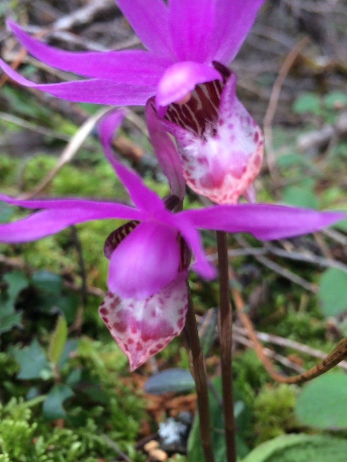 While Cataract Falls is a pretty hike at any time of the year, the rainy season is pretty much the best time of the year to visit. Plus, if you go right NOW, you’ll even see a multitude of fairy slippers, a native wild orchid.
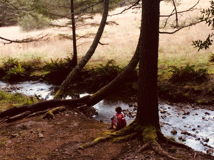
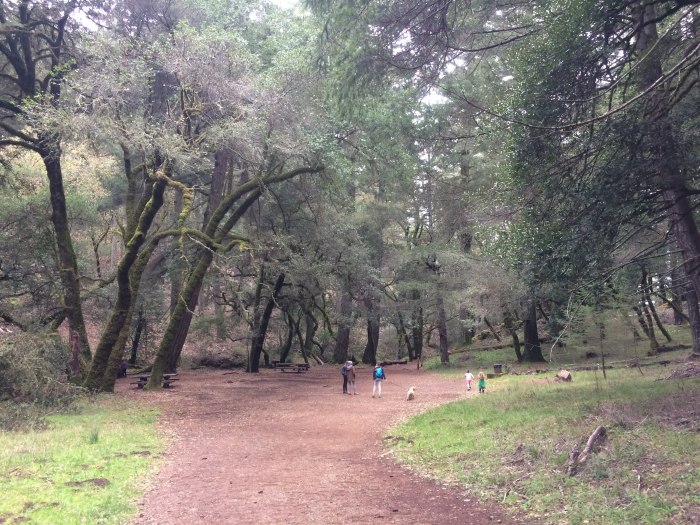 The simplest version of this hike is just to head out on Cataract trail, go to the first falls (about 1.6 miles from the parking lot) and then go back. Laurel Dell (pictured above) is a PERFECT place for lunch– several picnic tables under towering bay trees. If you have stronger hikers, you can head down to the second falls (we didn’t do this last weekend but the lower falls are beautiful, too) and then come back up. If you have hikers who can handle a bit more than 3 miles (think 4ish), then take Mickey O’Brien after Laurel Dell to Barth’s retreat, and then to Simmons trail back to Rock Springs. We did this trail and despite the numerous people on Cataract, I think we saw maybe 2 groups of people on Mickey O’Brien/Simmons trails. In other words, even in places where the humans flock, you can find some solitude. (If you really want to go crazy, you can go down Cataract to Helen Markt, and then back up Kent to High Marsh– I think this gives you about a 9 mile loop. Many options.)
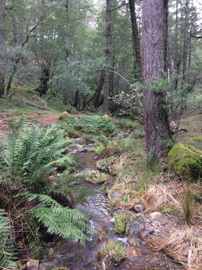
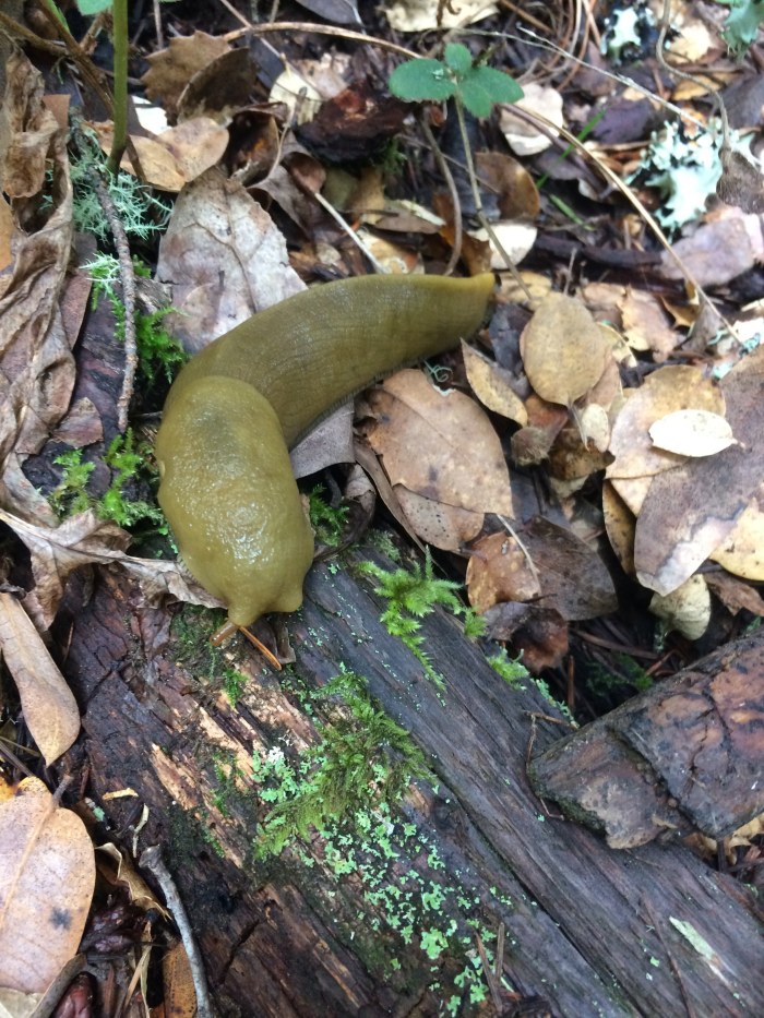 This trail is quintessential Mount Tam. Towering trees over shaded little brooks, wildflowers, banana slugs– it’s a tourist brochure waiting to happen. With the exception of the section from Laurel Dell to the falls, it’s also a fairly mellow hike without too much up & down. It’s an ideal hike for the 3-5 set, but as mentioned above, it’s easy to add on to create a longer outing. Get prepared for a long and windy drive up to the trailhead, but then go and enjoy. There’s a reason this trail is so popular. Figure out why for yourself.
 Additionally, you can take dogs on leash. WHAT. There are about 2.7 trails you can bring dogs on trails on Mount Tamalpais, so enjoy.


Pingback: Pinole Valley Watershed-secret trails with great views! | Bay Area Families Outside